Walk in the abyss at Newcastle Breakwater
Head out for a walk and watch the ships roll in. Free parking is available at Nobby’s Beach.
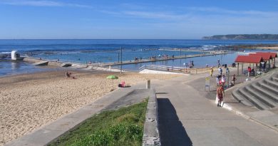
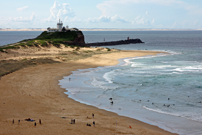
The south breakwater stretches approximately 0.9 km from Nobby’s Lighthouse. A return walk from the carpark takes just over half an hour, offering stunning views of the harbour and passing ships. The break-wall protects the harbour from waves. It’s a leisurely and accessible walk, suitable for all fitness levels.
The art of ships navigating Newcastle Harbour
Due to tides, depth, currents, and weather conditions, ships entering Newcastle Harbour must be steered with precision. Pilotage is compulsory, requiring experienced local pilots with in-depth knowledge of the harbour to safely navigate large vessels to port. Typically, a helicopter transports the pilot to the incoming ship, where they board and take control to ensure a safe entry.
Take a moment to appreciate the grandeur of these ships—often 300 meters long and up to 50 meters wide—navigating a channel approximately 15.2 meters deep. Watching them roll into port, you begin to grasp the incredible skill and precision required to guide these giants safely to port.
History of Newcastle break wall
In the period around 1791 to 1801 the Hunter Region was becoming known for its rich coal seams, mineral wealth and manufacturing potential was recognized.
In 1797, Lieutenant John Shortland of the Royal Navy, aboard the Governor’s whaleboat during a visit to Port Stephens, “discovered” the Newcastle River. In a letter to his father, he described the potential of the harbour emphasizing his perceived benefits of a river capable of accommodating ships loading 60 to 250 tons of cargo, not far from Sydney’s main settlement. Was this by happenstance? What were the business politics going on here?
In 1801, the first official exploration of the area was led by Colonel William Paterson, who reported his findings to Governor King. He highlighted the benefits of establishing a small settlement by the Hunter River, noting the excellent grazing pastures, fertile soil for agriculture, abundant fish, and mineral wealth in the region. Acting on this report, a settlement was quickly established and initially named Coal River.
Before the construction of the breakwater, entering the Hunter River by boat was fraught with danger. The lack of protection from rough seas made navigation treacherous, with unpredictable currents and shifting sandbars posing constant threats to ships. Mariners had to navigate these hazards carefully, often relying on local knowledge to safely enter the river. It wasn’t until the construction of the breakwater that the entrance to the river was made more secure, allowing for safer passage and the growth of trade and settlement in the region.
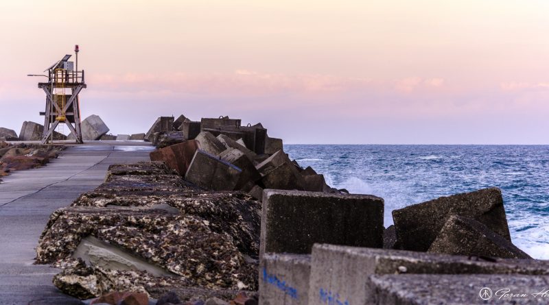
In 1813 construction began building the break wall to make harbour entry safer. The work took convicts 45 years to complete, finishing in 1857.
Over the years, the breakwater has been rebuilt multiple times due to storm damage.
Learn more
Feature image: Photo © Has, Goran. Newcastle Break wall. Via Flickr, 2016. Attribution (CC BY 2.0).